VolksNav in Yaounde
Click or doubleClick a point on map to know the logical urban area code of that point
Area codes for targets, crossings, stop points, bridges etc. consist of "hours", "minutes" and radius according to following convention:
| StatusQuo Yaounde | prefix of a position code | The urban pole is the Place Ahmadou Ahidjo |
| m12 | basic horizon hour | from urban pole to north, m3 to east etc. |
| number after the " : " | horizon minutes | distance to the horizon hour, in steps of 100 meters The blue lines on grid show :50 minutes |
| r... | radius |
distance to the urban pole, in steps of 100m. download Yaounde_r100.KML |
The map also shows markers of the bus stops of the line Olembé-Ahala. Clicking on them, their bus stop code will appear. According to the concept OmniBus, this line would be represented by the following pictograms:
 Lines m6 to m12 and m12 to m6
 Another design
Straight line representation:

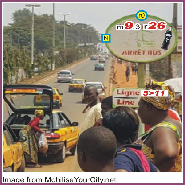
Example of a signage on the stop point YDE m9:3 r26 at Rue de Melén (blue marker on map):
 |
Convention: f12 = in front of you
north = f9 (left hand) YDE r0 = f12 (ahead) |
The division of the horizon into 12 directions can also be used global or indoor.
This map converts lat/lon to StatusQuo(c) on a simplified mode, tolerable for radius < 10 km. For a professional conversion, see VolksNav.com/mapplet